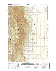
2014 Map of Summerville
USGS Topo · Published 2014About this map
Summerville sits at the edge of the Grande Ronde Valley in this Union County survey, where the valley floor abruptly meets the steep timberlands of the Whitman National Forest. The landscape is defined by the transition from irrigated agriculture to the west, marked by water management features like Wrights Reservoirs, Ordell Ditch, and Dobbin Ditch, to the dramatic elevation of Mt Emily. The terrain to the west is a complex network of named canyons and ridges, including Coon Canyon, Indian Trail Canyon, and the curiously named Fiddlers Hell. Numerous mountain springs such as Crystal Spring, Grandview Spring, and Mint Spring feed the creek systems that descend toward the valley floor, illustrating the vital water sources that supported both forestry and low-land farming in this part of Oregon.
Find a feature on this map
82 named features on this map. Tap any name to fly to it.
Don’t see what you’re looking for? This feature index may not catch every label — zoom into the map to look around manually.
Map Details
Editions of this 2014 Summerville Map
This is the sole edition of this map. No revisions or reprints were ever made.
Other maps of this area

1906 · Telocaset
USGS Topo · 1:125,000

1953 · Pendleton
USGS Topo · 1:250,000

1955 · Grangeville
USGS Topo · 1:250,000

1956 · Pendleton
USGS Topo · 1:250,000

1959 · Grangeville
USGS Topo · 1:250,000

1963 · La Grande SE
USGS Topo · 1:24,000

1963 · Sanderson Spring
USGS Topo · 1:24,000

1963 · Hilgard
USGS Topo · 1:24,000

1963 · Summerville
USGS Topo · 1:24,000

1964 · Thimbleberry Mtn
USGS Topo · 1:24,000