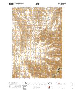
2020 Map of Summit Ridge
USGS Topo · Published 2020About this map
Summit Ridge serves as the high backbone for this landscape, dividing a complex network of canyons and hollows that drain toward the eastern boundary. In the southeast corner, the Deschutes River cuts a deep course along the border of Wasco and Sherman counties, joined by the mouth of Croft Canyon. The land is defined by these deep incisions into the plateau, with drainage features like Davis Cr, Bull Run Canyon, and Dry Canyon carving out the terrain.
Find a feature on this map
25 named features on this map. Tap any name to fly to it.
Don’t see what you’re looking for? This feature index may not catch every label — zoom into the map to look around manually.
Map Details
Editions of this 2020 Summit Ridge Map
This is the sole edition of this map. No revisions or reprints were ever made.
Other maps of this area

1930 · Dufur
USGS Topo · 1:125,000

1934 · Dufur
USGS Topo · 1:125,000

1934 · The Dalles
USGS Topo · 1:125,000

1953 · The Dalles
USGS Topo · 1:250,000

1956 · The Dalles
USGS Topo · 1:250,000

1957 · The Dalles
USGS Topo · 1:250,000

1957 · The Dalles
USGS Topo · 1:62,500

1957 · Wishram
USGS Topo · 1:62,500

1962 · Sherars Bridge
USGS Topo · 1:24,000

1962 · Erskine
USGS Topo · 1:24,000