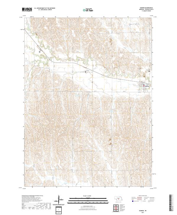
2021 Map of Sumner
USGS Topo · Published 2021About this map
Sumner sits as the central settlement in this portion of Dawson County, characterized by a transition from the drainage of the Wood River in the northwest to the agricultural lands of Park Valley in the northeast. The landscape is defined by a dense network of section roads, such as RD 770 and RD 767, which organize the rural territory around small water management features like Newquist Reservoir and Winter Reservoir. Genealogists will find significant value in the documentation of local burial grounds, including Saint Patricks Cem, Jewell Cem, and the Sumner Cem located just east of the town center. The southern portion of the quadrangle is defined by the winding path of Elm Cr, illustrating the vital role of local waterways in shaping the distribution of farmsteads and transport routes across the Nebraska plains.
Find a feature on this map
22 named features on this map. Tap any name to fly to it.
Don’t see what you’re looking for? This feature index may not catch every label — zoom into the map to look around manually.
Map Details
Editions of this 2021 Sumner Map
This is the sole edition of this map. No revisions or reprints were ever made.
Other maps of this area

1896 · Lexington
USGS Topo · 1:125,000

1896 · Kearney
USGS Topo · 1:125,000

1899 · Lexington
USGS Topo · 1:125,000

1951 · Mason City SW
USGS Topo · 1:24,000

1951 · Eddyville
USGS Topo · 1:24,000

1951 · Eddyville SW
USGS Topo · 1:24,000

1955 · Broken Bow
USGS Topo · 1:250,000

1955 · Grand Island
USGS Topo · 1:250,000

1956 · Broken Bow
USGS Topo · 1:250,000

1957 · Grand Island
USGS Topo · 1:250,000