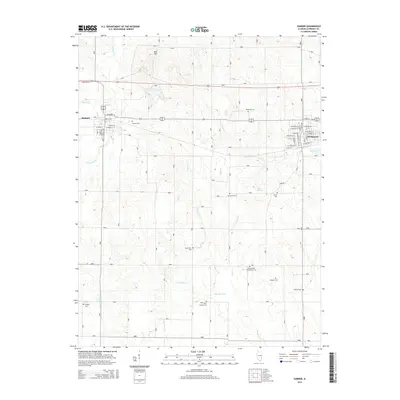
2015 Map of Sumner
USGS Topo · Published 2015About this map
Sumner and Bridgeport anchor this section of Lawrence County, Illinois, where the landscape is defined by a dense network of creek systems including Muddy Cr, Indian Cr, and Raccoon Cr. The terrain rises notably at Red Hill in the north, while the remainder of the area shows a highly developed rural grid. Genealogists will find this sheet particularly valuable for the unusual density of localized burial sites preserved across the countryside, such as Hopewell Cem, Shiloh Cem, and Olive Branch Cem. The map provides a detailed view of the street layouts in the primary settlements, including S Christy Ave in Sumner and the residential blocks surrounding School St in Bridgeport. These small-town centers are connected by a rural landscape dotted with landmarks like Stiver Springs and Immaculate Conception Cem, reflecting a long-standing pattern of community and agricultural life in the region.
Find a feature on this map
54 named features on this map. Tap any name to fly to it.
Don’t see what you’re looking for? This feature index may not catch every label — zoom into the map to look around manually.
Map Details
Editions of this 2015 Sumner Map
This is the sole edition of this map. No revisions or reprints were ever made.
Other maps of this area

1910 · Hardinville
USGS Topo · 1:62,500

1911 · Sumner
USGS Topo · 1:62,500

1913 · Sumner
USGS Topo · 1:62,500

1915 · Vincennes
USGS Topo · 1:62,500

1917 · Birds
USGS Topo · 1:62,500

1942 · Birds
USGS Topo · 1:62,500

1944 · Vincennes
USGS Topo · 1:62,500

1956 · Vincennes
USGS Topo · 1:250,000

1957 · Vincennes
USGS Topo · 1:250,000

1958 · Vincennes
USGS Topo · 1:250,000