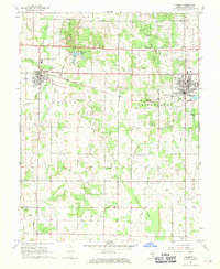
1968 Map of Sumner
USGS Topo · Published 1970About this map
Red Hills State Park dominates the northern landscape of this Lawrence County region, where Red Hills Lake and the Red Hills Chapel offer a dedicated recreational space amidst the surrounding agricultural and industrial activity. The corridor between Sumner and Bridgeport is defined by the Baltimore and Ohio railroad and a significant Gas and Oil Field, reflecting the area's mid-century economic reliance on both transportation and natural resource extraction.
Find a feature on this map
43 named features on this map. Tap any name to fly to it.
Don’t see what you’re looking for? This feature index may not catch every label — zoom into the map to look around manually.
Map Details
Editions of this 1968 Sumner Map
This is the sole edition of this map. No revisions or reprints were ever made.
Other maps of this area

1910 · Hardinville
USGS Topo · 1:62,500

1911 · Sumner
USGS Topo · 1:62,500

1913 · Sumner
USGS Topo · 1:62,500

1915 · Vincennes
USGS Topo · 1:62,500

1917 · Birds
USGS Topo · 1:62,500

1942 · Birds
USGS Topo · 1:62,500

1944 · Vincennes
USGS Topo · 1:62,500

1956 · Vincennes
USGS Topo · 1:250,000

1957 · Vincennes
USGS Topo · 1:250,000

1958 · Vincennes
USGS Topo · 1:250,000