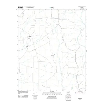
2011 Map of Sumpter
USGS Topo · Published 2011About this map
Sumpter and the surrounding rural communities of Bradley County are defined by a network of creeks and small family settlements. This landscape is marked by historical gathering points like Mount Olive, Mannstown, and Pattsville, each supported by its own namesake burial ground such as Mount Olive Cemetery and Pattsville Cemetery. The area is geographically bounded to the east by the Saline River, which collects drainage from several notable tributaries including Snake Creek, Grassy Pond Creek, and Beech Creek. In the southern reaches, the settlement of Smearny sits near the confluence of Little Snake Creek and the river, anchored by the Smearny Cemetery. The map reveals a dense system of county roads, such as County Rd 322 and Bradley Road 52, that connect these isolated hamlets through the pine-laden terrain typical of this part of Arkansas.
Find a feature on this map
58 named features on this map. Tap any name to fly to it.
Don’t see what you’re looking for? This feature index may not catch every label — zoom into the map to look around manually.
Map Details
Editions of this 2011 Sumpter Map
This is the sole edition of this map. No revisions or reprints were ever made.
Other maps of this area

1934 · Ingalls
USGS Topo · 1:48,000

1937 · Ingalls
USGS Topo · 1:62,500

1939 · Ingalls
USGS Topo · 1:62,500

1953 · Greenwood
USGS Topo · 1:250,000

1953 · El Dorado
USGS Topo · 1:250,000

1956 · Greenwood
USGS Topo · 1:250,000

1957 · El Dorado
USGS Topo · 1:250,000

1958 · El Dorado
USGS Topo · 1:250,000

1960 · El Dorado
USGS Topo · 1:250,000
1971 · Vick
USGS Topo · 1:24,000