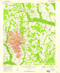
1957 Map of Sumter East
USGS Topo · Published 1958About this map
Sumter serves as the focal point of this mid-century survey, revealing a dense network of schools and civic institutions that anchored the community during a period of steady growth. The educational landscape is particularly dense, featuring Morris College, Edmunds High Sch, and Lincoln High Sch, alongside numerous neighborhood campuses like Savage Glover Sch and Stone Hill Sch. The city is encircled by a transition from urban development to rural crossroads such as Quinns Crossroad and Rocky Bluff Crossroads, where family names like White-Dick Cem and Brogden Cem mark the lineage of local residents.
Find a feature on this map
85 named features on this map. Tap any name to fly to it.
Don’t see what you’re looking for? This feature index may not catch every label — zoom into the map to look around manually.
Map Details
Editions of this 1957 Sumter East Map
3 editions found
Other maps of this area

1920 · Mayesville
USGS Topo · 1:48,000

1921 · Mayesville
USGS Topo · 1:62,500

1941 · Spartanburg
USGS Topo · 1:250,000

1943 · Mayesville
USGS Topo · 1:62,500

1946 · Sumter
USGS Topo · 1:62,500

1953 · Spartanburg
USGS Topo · 1:250,000

1954 · Augusta
USGS Topo · 1:250,000

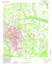
1957 · Sumter East
USGS Topo · 1:24,000

1957 · Sumter West
USGS Topo · 1:24,000

1957 · Ashwood
USGS Topo · 1:62,500