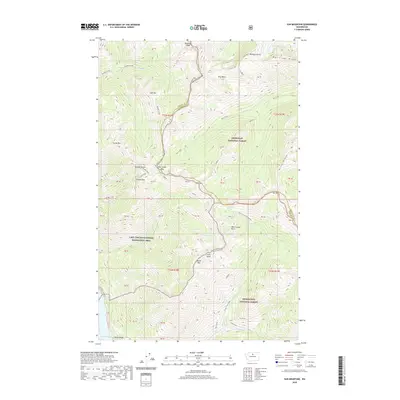
2020 Map of Sun Mountain
USGS Topo · Published 2020About this map
Reynolds Peak and Williams Butte define the high ridgelines at the northern edge of this high-altitude landscape where the Chelan and Okanogan county line follows the watershed divide. This 2020 survey of the North Cascades captures a wilderness managed by multiple agencies, including the Okanogan National Forest, Wenatchee National Forest, and the Lake Chelan National Recreation Area.
Find a feature on this map
61 named features on this map. Tap any name to fly to it.
Don’t see what you’re looking for? This feature index may not catch every label — zoom into the map to look around manually.
Map Details
Editions of this 2020 Sun Mountain Map
This is the sole edition of this map. No revisions or reprints were ever made.
Other maps of this area

1899 · Methow
USGS Topo · 1:125,000

1901 · Methow
USGS Topo · 1:125,000

1902 · Stehekin
USGS Topo · 1:125,000

1904 · Stehekin
USGS Topo · 1:125,000

1944 · Lucerne
USGS Topo · 1:62,500

1949 · Lucerne
USGS Topo · 1:62,500

1955 · Concrete
USGS Topo · 1:250,000

1958 · Concrete
USGS Topo · 1:250,000

1962 · Concrete
USGS Topo · 1:250,000
1969 · Midnight Mtn.
USGS Topo · 1:24,000