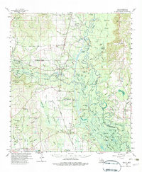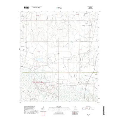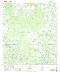
1983 Map of Sun
USGS Topo · Published 1984About this map
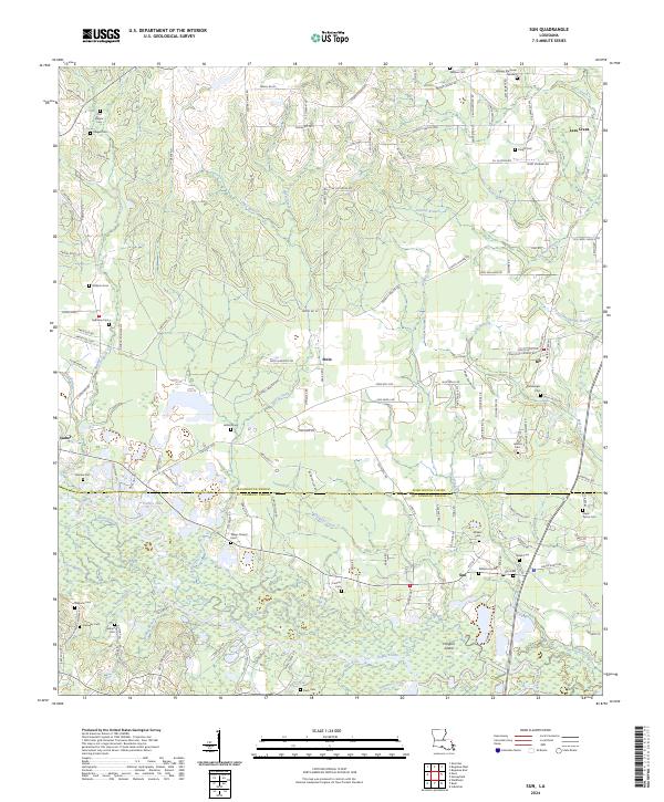
The Bogue Chitto River defines the landscape of the Louisiana piney woods at the transition between Washington Parish and St Tammany Parish. This early 1980s landscape is a complex network of waterways including Old River, Little River, and numerous sloughs like Sandy Slough and Fish Slough. Along the eastern corridor, the Illinois Central Gulf Railroad anchors small rural settlements such as Rio and Sun. Cultural and genealogical sites are densely plotted, from the American Academy near Lees Creek to numerous family-named burial grounds like Old Magee Cem, Knight Cem, and the Jewel Pierce Cem. The presence of Lock No 3 on the river system highlights the historical importance of waterway management in this timber and agricultural region, while various churches such as Emmanuel Ch and Zion Ch serve as local community anchors.
Find a feature on this map
67 named features on this map. Tap any name to fly to it.
Don’t see what you’re looking for? This feature index may not catch every label — zoom into the map to look around manually.
Map Details
Editions of this 1983 Sun Map
This is the sole edition of this map. No revisions or reprints were ever made.
Historical Maps of Sun Through Time
7 maps found