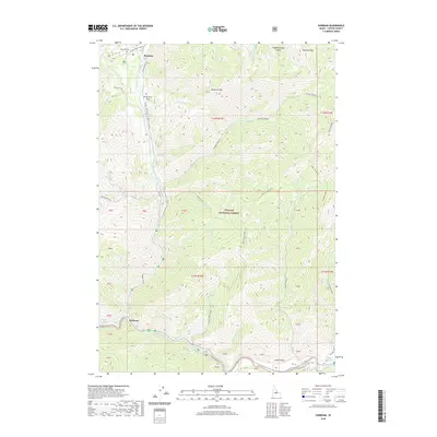
2020 Map of Sunbeam
USGS Topo · Published 2020About this map
Bonanza serves as a primary point of reference in this high-altitude landscape within the Salmon River drainage. The area's settlement history is marked by isolated outposts like Preachers Cove, reflecting the difficult terrain of the central Idaho mountains. This survey illustrates the hydrological network defined by the W Fork Yankee Fork, showing how early transport and settlement patterns followed the narrow valley floors. The distribution of named features suggests a history tied to the remote mining and prospecting efforts that once defined this portion of the Challis National Forest, where geography dictated the placement of every cabin and campsite.
Find a feature on this map
3 named features on this map. Tap any name to fly to it.
Don’t see what you’re looking for? This feature index may not catch every label — zoom into the map to look around manually.
Map Details
Editions of this 2020 Sunbeam Map
This is the sole edition of this map. No revisions or reprints were ever made.
Other maps of this area

1919 · Custer
USGS Topo · 1:125,000

1922 · Custer
USGS Topo · 1:125,000

1957 · Challis
USGS Topo · 1:250,000

1960 · Challis
USGS Topo · 1:250,000

1963 · Challis
USGS Topo · 1:250,000

1963 · Custer
USGS Topo · 1:24,000
1963 · Elevenmile Creek
USGS Topo · 1:24,000

1963 · Casino Lakes
USGS Topo · 1:24,000
1964 · Robinson Bar
USGS Topo · 1:24,000
1964 · Mt Jordan
USGS Topo · 1:24,000