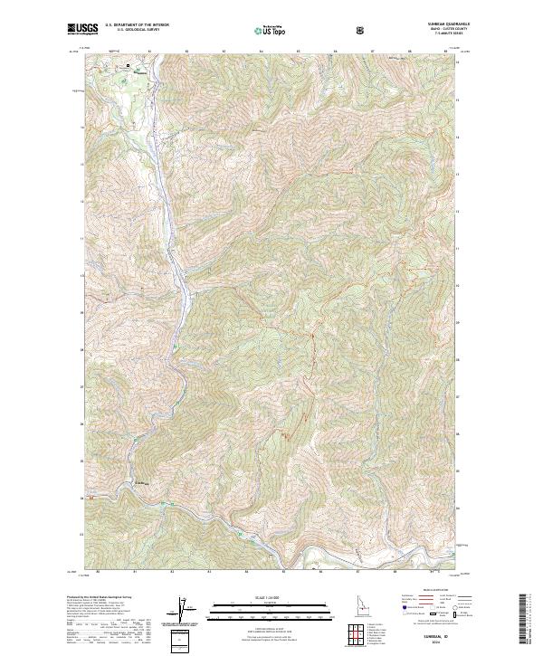
2024 Map of Sunbeam
USGS Topo · Published 2024About this map
Bonanza and Sunbeam represent the primary points of human settlement in this high-altitude landscape where the Yankee Fork meets the Salmon River. The terrain is defined by extreme relief, rising from the riverbanks to the heights of Bonanza Peak and Bachelor Mtn. Evidence of the area's pioneer and mining history is preserved at the Bonanza Cemetery and the site of Preachers Cove along the Yankee Fork Road. Natural features like Sunbeam Hot Springs and Indian Riffles punctuate the river corridors, which have long served as the primary conduits for travel and industry. Much of the surrounding land is managed as part of the Challis National Forest, with the southern portion dedicated to the White Cloud Wilderness. Numerous pack trails, such as the Muley Cutoff Trail and Sawmill Creek Trail, spiderweb through the drainages of Peach Creek and Jerrys Creek, indicating a landscape still largely accessible only by foot or horse.
Find a feature on this map
59 named features on this map. Tap any name to fly to it.
Don’t see what you’re looking for? This feature index may not catch every label — zoom into the map to look around manually.
Map Details
Editions of this 2024 Sunbeam Map
This is the sole edition of this map. No revisions or reprints were ever made.
Other maps of this area

1919 · Custer
USGS Topo · 1:125,000

1922 · Custer
USGS Topo · 1:125,000

1957 · Challis
USGS Topo · 1:250,000

1960 · Challis
USGS Topo · 1:250,000

1963 · Challis
USGS Topo · 1:250,000

1963 · Custer
USGS Topo · 1:24,000
1963 · Elevenmile Creek
USGS Topo · 1:24,000

1963 · Casino Lakes
USGS Topo · 1:24,000
1964 · Robinson Bar
USGS Topo · 1:24,000
1964 · Mt Jordan
USGS Topo · 1:24,000