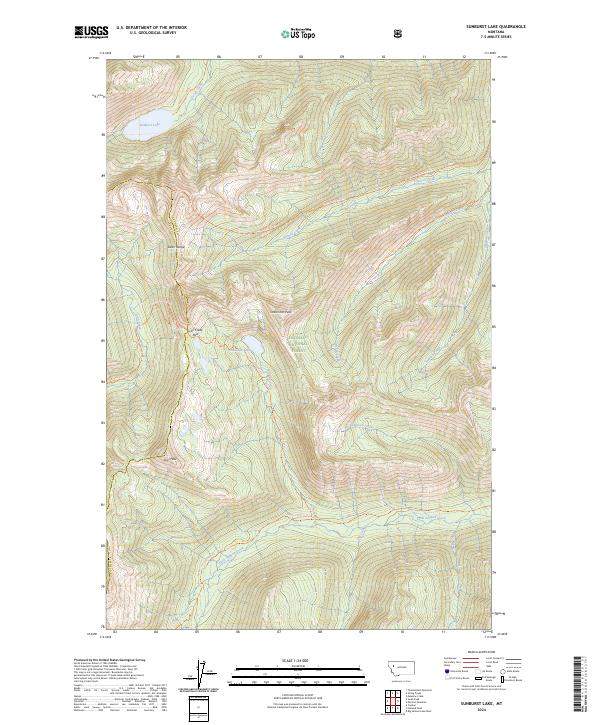
2024 Map of Sunburst Lake
USGS Topo · Published 2024About this map
Bob Marshall Wilderness dominates this 2024 quadrangle, revealing a landscape defined by the high peaks of the Swan Range and a dense network of alpine drainages. The map centers on Oreamnos Peak and the critical transition at Lion Creek Pass, where the terrain drops into the vast Flathead National Forest. This modern survey details the vital water systems of the region, from the primary basin of Sunburst Lake to the headwaters of Little Salmon Creek and Stadium Creek.
Find a feature on this map
28 named features on this map. Tap any name to fly to it.
Don’t see what you’re looking for? This feature index may not catch every label — zoom into the map to look around manually.
Map Details
Editions of this 2024 Sunburst Lake Map
This is the sole edition of this map. No revisions or reprints were ever made.
Other maps of this area

1936 · Silvertip
USGS Topo · 1:96,000

1942 · Silvertip
USGS Topo · 1:125,000

1955 · Choteau
USGS Topo · 1:250,000

1957 · Choteau
USGS Topo · 1:250,000

1958 · Choteau
USGS Topo · 1:250,000

1962 · Choteau
USGS Topo · 1:250,000

1965 · Condon
USGS Topo · 1:24,000

1965 · Sunburst Lake
USGS Topo · 1:24,000
1965 · Thunderbolt Mountain
USGS Topo · 1:24,000

1965 · Swan Peak
USGS Topo · 1:24,000