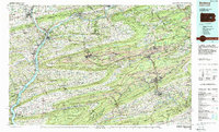
1984 Map of Sunbury
USGS Topo · Published 1988About this map
The Susquehanna River and its West Branch define the western landscape of this 1980s-era topographical study, meeting at Sunbury before cutting through the parallel ridges of the Appalachian Mountains. To the east, the intensive development of the Pennsylvania Anthracite region is evident in the dense settlement patterns of Shamokin, Mount Carmel, and Shenandoah. These towns are tightly constrained by the surrounding terrain of Mahanoy Mountain and Sharp Mountain, illustrating the industrial footprint of a region built on coal and iron.
Find a feature on this map
222 named features on this map. Tap any name to fly to it.
Don’t see what you’re looking for? This feature index may not catch every label — zoom into the map to look around manually.
Map Details
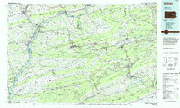
Editions of this 1984 Sunbury Map
2 editions found
Other maps of this area

1889 · Catawissa
USGS Topo · 1:62,500

1889 · Hazleton
USGS Topo · 1:62,500

1889 · Pottsville
USGS Topo · 1:62,500

1891 · Wilkesbarre
USGS Topo · 1:62,500

1891 · Hazleton
USGS Topo · 1:62,500

1891 · Pottsville
USGS Topo · 1:62,500

1891 · Lebanon
USGS Topo · 1:62,500

1892 · Catawissa
USGS Topo · 1:62,500

1892 · Lykens
USGS Topo · 1:62,500

1892 · Hummelstown
USGS Topo · 1:62,500