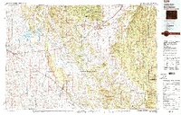
1979 Map of Sundance
USGS Topo · Published 1979About this map
The Black Hills National Forest dominates the eastern expanse of this 1970s landscape, where the rugged topography of the Black Hills meets the high plains. Central to the region's cultural history is the Historical Monument (Custer Expedition), marking the 1874 path through these highlands. To the west, the Keyhole Reservoir collects the waters of the Belle Fourche River, a critical resource for the surrounding ranching and mining country. Transportation and industry are defined by the Burlington Northern railroad, which threads through the southwestern corridor connecting Moorcroft and Upton.
Find a feature on this map
98 named features on this map. Tap any name to fly to it.
Don’t see what you’re looking for? This feature index may not catch every label — zoom into the map to look around manually.
Map Details
Editions of this 1979 Sundance Map
2 editions found

Other maps of this area

1894 · Deadwood
USGS Topo · 1:125,000

1896 · Harney Peak
USGS Topo · 1:125,000

1898 · Sundance
USGS Topo · 1:125,000

1899 · Newcastle
USGS Topo · 1:125,000

1900 · Spearfish
USGS Topo · 1:62,500

1901 · Harney Peak
USGS Topo · 1:125,000

1901 · Deadwood
USGS Topo · 1:125,000

1901 · Newcastle
USGS Topo · 1:125,000

1901 · Aladdin
USGS Topo · 1:125,000

1902 · Sundance
USGS Topo · 1:125,000