
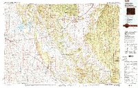
1979 Map of Sundance
USGS Topo · Published 1979About this map
The Black Hills National Forest straddles the border of Wyoming and South Dakota, where rugged elevations meet the prairie. In the late 1970s, the landscape around Sundance and Moorcroft is defined by a network of established ranching routes and industrial corridors. The Burlington Northern and Chicago and North Western railroads traverse the terrain, reflecting the region's reliance on rail transport for minerals and livestock.
Find a feature on this map
74 named features on this map. Tap any name to fly to it.
Don’t see what you’re looking for? This feature index may not catch every label — zoom into the map to look around manually.
Map Details
Editions of this 1979 Sundance Map
2 editions found
Other maps of this area

1894 · Deadwood
USGS Topo · 1:125,000

1896 · Harney Peak
USGS Topo · 1:125,000

1898 · Sundance
USGS Topo · 1:125,000

1899 · Newcastle
USGS Topo · 1:125,000

1900 · Spearfish
USGS Topo · 1:62,500

1901 · Harney Peak
USGS Topo · 1:125,000

1901 · Deadwood
USGS Topo · 1:125,000

1901 · Newcastle
USGS Topo · 1:125,000

1901 · Aladdin
USGS Topo · 1:125,000

1902 · Sundance
USGS Topo · 1:125,000