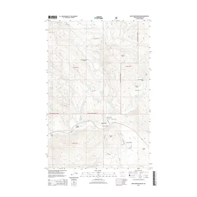
2014 Map of Sunflower Mountain
USGS Topo · Published 2014About this map
The Blackfoot River carves a deep valley through this portion of the Lolo National Forest in Missoula County. The settlement at McNamara and the McNamara Bridge serve as focal points for the local transport network, where Johnsrud Park Rd and Gold Creek Rd navigate the steep, forested slopes. The terrain is defined by prominent peaks like Sunflower Mtn and Diamond Mtn, with numerous drainages such as Union Cr and W Fork Gold Cr feeding into the main river system. Small clearings and flatlands like Sheep Flats and Camas Prairie offer brief respites from the dense timber of the national forest. Local landmarks such as Johnsrud Park and the small community of Twin Creeks reflect the long-standing human presence in this timber and river corridor.
Find a feature on this map
45 named features on this map. Tap any name to fly to it.
Don’t see what you’re looking for? This feature index may not catch every label — zoom into the map to look around manually.
Map Details
Editions of this 2014 Sunflower Mountain Map
This is the sole edition of this map. No revisions or reprints were ever made.
Other maps of this area

1903 · Bonner
USGS Topo · 1:125,000

1921 · Elbow Lake
USGS Topo · 1:125,000

1947 · Butte
USGS Topo · 1:250,000

1955 · Choteau
USGS Topo · 1:250,000

1957 · Choteau
USGS Topo · 1:250,000

1958 · Butte
USGS Topo · 1:250,000

1958 · Choteau
USGS Topo · 1:250,000

1960 · Butte
USGS Topo · 1:250,000

1962 · Choteau
USGS Topo · 1:250,000

1962 · Butte
USGS Topo · 1:250,000