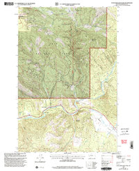
1999 Map of Sunflower Mountain
USGS Topo · Published 2003About this map
The Blackfoot River carves a sharp path through Missoula County, anchoring a landscape of timbered ridges and river-bottom landings at the turn of the millennium. Small riverside settlements like McNamara and Rainbow Bend sit along the primary transit corridor, while the nearby McNamara Bridge provides a vital link across the water. This territory is characterized by the convergence of major public lands, including the eastern reaches of the Rattlesnake National Recreation Area and the vast Lolo National Forest.
Find a feature on this map
34 named features on this map. Tap any name to fly to it.
Don’t see what you’re looking for? This feature index may not catch every label — zoom into the map to look around manually.
Map Details
Editions of this 1999 Sunflower Mountain Map
This is the sole edition of this map. No revisions or reprints were ever made.
Other maps of this area

1903 · Bonner
USGS Topo · 1:125,000

1921 · Elbow Lake
USGS Topo · 1:125,000

1947 · Butte
USGS Topo · 1:250,000

1955 · Choteau
USGS Topo · 1:250,000

1957 · Choteau
USGS Topo · 1:250,000

1958 · Butte
USGS Topo · 1:250,000

1958 · Choteau
USGS Topo · 1:250,000

1960 · Butte
USGS Topo · 1:250,000

1962 · Choteau
USGS Topo · 1:250,000

1962 · Butte
USGS Topo · 1:250,000