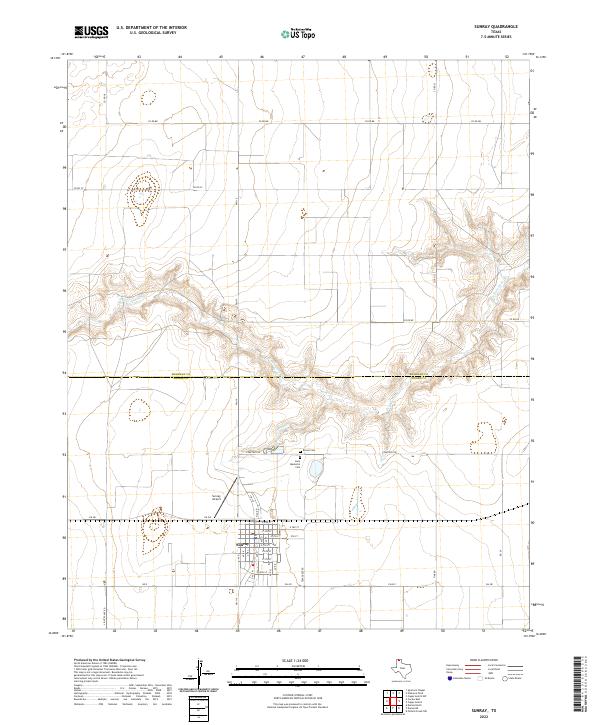
2022 Map of Sunray
USGS Topo · Published 2022About this map
Sunray sits at the southern edge of this West Texas landscape, organized around a grid of streets including E 4th St and E 10th St. The town is positioned just south of the Sherman and Moore county line, a boundary that cuts through the deeply carved drainage of N Palo Duro Cr. This creek system creates a complex network of canyons and breaks that contrast sharply with the surrounding flat agricultural and ranching lands.
Find a feature on this map
28 named features on this map. Tap any name to fly to it.
Don’t see what you’re looking for? This feature index may not catch every label — zoom into the map to look around manually.
Map Details
Editions of this 2022 Sunray Map
This is the sole edition of this map. No revisions or reprints were ever made.
Other maps of this area

1954 · Perryton
USGS Topo · 1:250,000

1954 · Amarillo
USGS Topo · 1:250,000

1958 · Perryton
USGS Topo · 1:250,000

1958 · Amarillo
USGS Topo · 1:250,000

1963 · Cactus East
USGS Topo · 1:24,000

1965 · Spurlock Chapel
USGS Topo · 1:24,000
1965 · Dumas North
USGS Topo · 1:24,000

1972 · Dumas NE
USGS Topo · 1:24,000

1972 · Capps Switch
USGS Topo · 1:24,000

1972 · Sunray
USGS Topo · 1:24,000