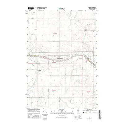
2016 Map of Sunrise
USGS Topo · Published 2016About this map
The Sunrise settlement serves as the focal point of this Chisago County survey, positioned near the confluence of the Sunrise River and the Saint Croix River. This riverine landscape is defined by the Saint Croix National Scenic Riverway, which marks the natural border between Minnesota and Wisconsin. For genealogists, the map preserves the locations of the Old Settlers Cem and Sunrise Cem, while the Sunrise Ferry Hiking Trl and various family-named roads like Nelson Rd and Peterson Ave suggest a long history of local land use. The drainage network is particularly dense here, featuring Cowan Cr, Trade River, and Hay Cr, illustrating the complex hydrology that influenced the early development and transport routes of the Sunrise Township area.
Find a feature on this map
57 named features on this map. Tap any name to fly to it.
Don’t see what you’re looking for? This feature index may not catch every label — zoom into the map to look around manually.
Map Details
Editions of this 2016 Sunrise Map
This is the sole edition of this map. No revisions or reprints were ever made.
Other maps of this area

1900 · St Croix Dalles
USGS Topo · 1:62,500

1901 · St Croix Dalles
USGS Topo · 1:62,500

1950 · Rush City
USGS Topo · 1:48,000

1951 · Milltown
USGS Topo · 1:48,000

1953 · Stillwater
USGS Topo · 1:250,000

1955 · St. Croix Dalles
USGS Topo · 1:62,500

1955 · Rush City
USGS Topo · 1:62,500

1955 · Milltown
USGS Topo · 1:62,500

1955 · Forest Lake
USGS Topo · 1:62,500

1955 · Stillwater
USGS Topo · 1:250,000