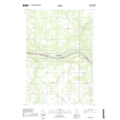
2019 Map of Sunrise
USGS Topo · Published 2019About this map
The confluence of the Sunrise River and the Saint Croix River anchors this landscape along the Minnesota and Wisconsin border. The village of Sunrise occupies a central position west of the river, served by a network of rural roads such as Sunrise Rd and Ferry Rd that hint at the area's history of river crossings. The protected lands of the Saint Croix National Scenic Riverway define the eastern edge of the quadrangle, preserving the riparian corridor where the Trade River joins the main stem. For local historians and genealogists, the map identifies significant burial sites including Old Settlers Cem to the north and Sunrise Cem near the town center. The terrain is marked by a complex system of small waterways like Cowan Cr and Hay Cr, alongside modern recreational paths such as the Sunrise Ferry Hiking Trl and the Electric Line Trl.
Find a feature on this map
59 named features on this map. Tap any name to fly to it.
Don’t see what you’re looking for? This feature index may not catch every label — zoom into the map to look around manually.
Map Details
Editions of this 2019 Sunrise Map
This is the sole edition of this map. No revisions or reprints were ever made.
Other maps of this area

1900 · St Croix Dalles
USGS Topo · 1:62,500

1901 · St Croix Dalles
USGS Topo · 1:62,500

1950 · Rush City
USGS Topo · 1:48,000

1951 · Milltown
USGS Topo · 1:48,000

1953 · Stillwater
USGS Topo · 1:250,000

1955 · St. Croix Dalles
USGS Topo · 1:62,500

1955 · Rush City
USGS Topo · 1:62,500

1955 · Milltown
USGS Topo · 1:62,500

1955 · Forest Lake
USGS Topo · 1:62,500

1955 · Stillwater
USGS Topo · 1:250,000