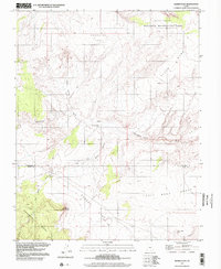
1997 Map of Sunset Flat
USGS Topo · Published 2002About this map
Sunset Flat and the surrounding high desert terrain on the Garfield and Kane County line define this late-twentieth-century landscape. The area is dominated by broad, named plateaus and benches, such as Early Weed Bench and Fiftymile Bench, which are dissected by seasonal drainage systems including Twentymile Wash and Twentyfive Mile Wash. While much of the northern territory is protected as part of the Glen Canyon National Recreation Area, the map documents the sparse but vital human infrastructure required for land management and ranching. The presence of Twentyfive-Mile Corral and watering points like Little Red Rock Spring and the simple Spring at the head of Rat Seep Hollow highlights the precarious nature of water access in these dry reaches of southern Utah.
Find a feature on this map
18 named features on this map. Tap any name to fly to it.
Don’t see what you’re looking for? This feature index may not catch every label — zoom into the map to look around manually.
Map Details
Editions of this 1997 Sunset Flat Map
This is the sole edition of this map. No revisions or reprints were ever made.
Other maps of this area

1886 · Escalante
USGS Topo · 1:250,000

1922 · Rees Canyon
USGS Topo · 1:63,360

1953 · Circle Cliffs 4 NW
USGS Topo · 1:24,000

1953 · Circle Cliffs 4 SW
USGS Topo · 1:24,000

1953 · Moody Creek
USGS Topo · 1:62,500

1956 · Escalante
USGS Topo · 1:250,000

1960 · Escalante
USGS Topo · 1:250,000

1964 · Sunset Flat
USGS Topo · 1:24,000

1964 · Tenmile Flat
USGS Topo · 1:24,000

1964 · Seep Flat
USGS Topo · 1:24,000