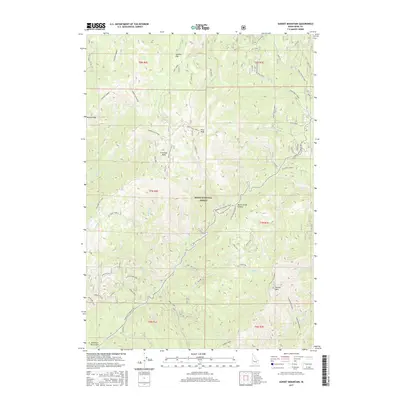
2017 Map of Sunset Mountain
USGS Topo · Published 2017About this map
Pilot Peak Lookout and Sunset Mtn Lookout stand as prominent high points in this section of the Boise National Forest. The landscape is defined by its drainage systems and ridges, notably the Grimes-Elk Divide and Hungarian Ridge. Mining history is evidenced by the American Girl and Eight Mile labels in the southwest, while the winding Idaho City-Stanley-SH21 provides the primary passage through the high country, crossing at Mores Creek Summit. Waterways such as Grimes Cr, Mores Cr, and the colorfully named Whoop-Um-Up Creek carve through the terrain, supporting recreational sites like Hay Fork Cg. This 2017 survey details a network of forest spurs and trails that illustrate the modern management of this backcountry region between Wilson Peak and Sunset Mtn.
Find a feature on this map
75 named features on this map. Tap any name to fly to it.
Don’t see what you’re looking for? This feature index may not catch every label — zoom into the map to look around manually.
Map Details
Editions of this 2017 Sunset Mountain Map
This is the sole edition of this map. No revisions or reprints were ever made.
Other maps of this area

1894 · Idaho Basin
USGS Topo · 1:125,000

1909 · Garden Valley
USGS Topo · 1:125,000

1955 · Hailey
USGS Topo · 1:250,000

1957 · Pioneerville
USGS Topo · 1:24,000

1957 · Idaho City
USGS Topo · 1:24,000

1957 · Challis
USGS Topo · 1:250,000

1959 · Hailey
USGS Topo · 1:250,000

1959 · Garden Valley
USGS Topo · 1:62,500

1960 · Challis
USGS Topo · 1:250,000

1962 · Hailey
USGS Topo · 1:250,000