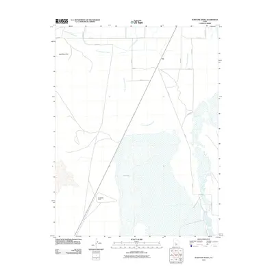
2010 Map of Sunstone Knoll
USGS Topo · Published 2010About this map
Old Channel Sevier River winds through the arid floor of the Sevier Desert in this 2010 survey of Millard County. The landscape is defined by its remnants of ancient hydrography and volcanic geology, most notably the landmark at Sunstone Knoll and the nearby Great Stone Face. Human settlement is sparse, concentrated at the small community of Van near the intersection of the regional road network. The presence of the North Ditch and the sprawling Salt Lake to the south indicates the ongoing management of water resources in a region where historical river channels have shifted over time. This map captures the intersection of early 21st-century infrastructure with the enduring topographic features of central Utah.
Find a feature on this map
19 named features on this map. Tap any name to fly to it.
Don’t see what you’re looking for? This feature index may not catch every label — zoom into the map to look around manually.
Map Details
Editions of this 2010 Sunstone Knoll Map
This is the sole edition of this map. No revisions or reprints were ever made.
Other maps of this area

1885 · Sevier Desert
USGS Topo · 1:250,000

1953 · Delta
USGS Topo · 1:250,000

1958 · Delta
USGS Topo · 1:250,000

1962 · Delta
USGS Topo · 1:250,000

1962 · Delta
USGS Topo · 1:62,500

1971 · Pavant Butte North
USGS Topo · 1:24,000

1971 · Neels
USGS Topo · 1:24,000

1971 · Sunstone Knoll
USGS Topo · 1:24,000
1971 · Pot Mountain
USGS Topo · 1:24,000
1971 · Clear Lake
USGS Topo · 1:24,000