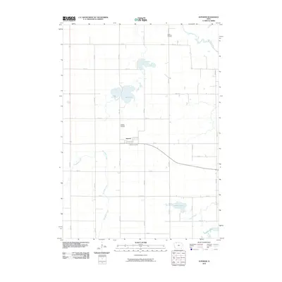
2010 Map of Superior
USGS Topo · Published 2010About this map
Superior serves as the central hub of this Dickinson County landscape, characterized by a grid of agricultural roads and significant glacial water bodies. The settlement is anchored by the Superior Post Office, while the surrounding township is marked by local heritage sites such as the Superior Township Cemetery and the Union State Line Cemetery to the north. The terrain is defined by its drainage patterns, with Big Muddy Creek and School Creek winding through the fields toward larger features like Swan Lake and Fourmile Lake.
Find a feature on this map
28 named features on this map. Tap any name to fly to it.
Don’t see what you’re looking for? This feature index may not catch every label — zoom into the map to look around manually.
Map Details
Editions of this 2010 Superior Map
This is the sole edition of this map. No revisions or reprints were ever made.
Other maps of this area

1954 · Fairmont
USGS Topo · 1:250,000

1958 · Fairmont
USGS Topo · 1:250,000

1970 · Jackson
USGS Topo · 1:24,000

1970 · Lakefield SE
USGS Topo · 1:24,000

1970 · Spirit Lake SE
USGS Topo · 1:24,000

1970 · Dunnell
USGS Topo · 1:24,000

1970 · Spirit Lake
USGS Topo · 1:24,000

1972 · Terril
USGS Topo · 1:24,000

1972 · Wallingford
USGS Topo · 1:24,000

1972 · Estherville
USGS Topo · 1:24,000