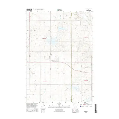
2015 Map of Superior
USGS Topo · Published 2015About this map
Superior sits at the heart of this agricultural landscape in the mid-2010s, positioned along the border where Dickinson and Emmet Counties meet. The township's character is defined by a dense network of sectional roads like 330th Ave and Co Rd A20 that segment the prairie into a productive grid. Notable for its glacial hydrology, the area features prominent water bodies including Swan Lake and the wetlands of Christopherson Slough, while the Des Moines River cuts through the northeast corner. For local historians, the map preserves the exact locations of the Superior Township Cem and the Union State Line Cem near the Minnesota border. Small watercourses such as Big Muddy Cr and School Cr drain the fields, feeding into the larger basins of Fourmile Lake and Cheever Lake.
Find a feature on this map
40 named features on this map. Tap any name to fly to it.
Don’t see what you’re looking for? This feature index may not catch every label — zoom into the map to look around manually.
Map Details
Editions of this 2015 Superior Map
This is the sole edition of this map. No revisions or reprints were ever made.
Other maps of this area

1954 · Fairmont
USGS Topo · 1:250,000

1958 · Fairmont
USGS Topo · 1:250,000

1970 · Jackson
USGS Topo · 1:24,000

1970 · Lakefield SE
USGS Topo · 1:24,000

1970 · Spirit Lake SE
USGS Topo · 1:24,000

1970 · Dunnell
USGS Topo · 1:24,000

1970 · Spirit Lake
USGS Topo · 1:24,000

1972 · Terril
USGS Topo · 1:24,000

1972 · Wallingford
USGS Topo · 1:24,000

1972 · Estherville
USGS Topo · 1:24,000