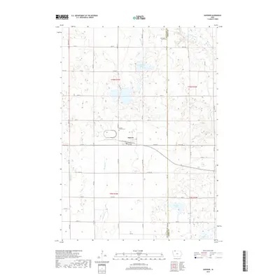
2018 Map of Superior
USGS Topo · Published 2018About this map
Superior sits at the heart of this Dickinson County landscape, oriented around the intersection of 150th ST and the Burlington Ave corridor. The geography is defined by a dense network of glacial wetlands and water bodies, including the expansive Swan Lake just north of town and Christopherson Slough further to the northeast. The Des Moines River meanders across the northeast corner, while the southern reaches are marked by Fourmile Lake and Cheever Lake. Local history is anchored by the Superior Township Cem and the Union State Line Cem, the latter situated right on the northern boundary. The grid of county roads and drainage systems like Ditch Number 22 and Ditch Number 79 illustrates the intensive agricultural management of this prairie terrain, where natural watercourses like Big Muddy Cr and School Cr have been integrated into a highly structured rural landscape.
Find a feature on this map
34 named features on this map. Tap any name to fly to it.
Don’t see what you’re looking for? This feature index may not catch every label — zoom into the map to look around manually.
Map Details
Editions of this 2018 Superior Map
This is the sole edition of this map. No revisions or reprints were ever made.
Other maps of this area

1954 · Fairmont
USGS Topo · 1:250,000

1958 · Fairmont
USGS Topo · 1:250,000

1970 · Jackson
USGS Topo · 1:24,000

1970 · Lakefield SE
USGS Topo · 1:24,000

1970 · Spirit Lake SE
USGS Topo · 1:24,000

1970 · Dunnell
USGS Topo · 1:24,000

1970 · Spirit Lake
USGS Topo · 1:24,000

1972 · Terril
USGS Topo · 1:24,000

1972 · Wallingford
USGS Topo · 1:24,000

1972 · Estherville
USGS Topo · 1:24,000