2022 Map of Superior
USGS Topo · Published 2022About this map
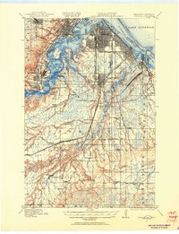
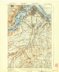
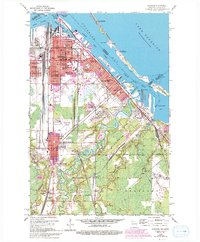
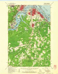
Superior is defined by its industrial waterfront and complex network of harbor channels where the Nemadji River and Pokegama River meet the western edge of Lake Superior. The city’s layout reflects its role as a major port and transit hub, with neighborhoods like Billings Park, East End, and Allouez flanking the active shipping lanes of Superior Bay and the Superior Harbor Basin. The presence of the University of Wisconsin Superior and the Douglas County Courthouse highlights the city's standing as a regional center of education and government. Beyond the urban grid, the map details many local landmarks of genealogical interest, including Nemadji Cem, Riverside Cem, and Greenwood Cem. Aviation history is present at both Richard I Bong Airport and the unique Sky Harbor Airport on Minnesota Point, while the southeastern reaches near Itasca and Ambridge transition into a landscape of creeks and rail corridors.
Find a feature on this map
55 named features on this map. Tap any name to fly to it.
Don’t see what you’re looking for? This feature index may not catch every label — zoom into the map to look around manually.
Map Details
Editions of this 2022 Superior Map
This is the sole edition of this map. No revisions or reprints were ever made.
Historical Maps of Ambridge Through Time
5 maps found