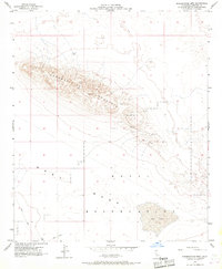
1956 Map of Superstition Mtn.
USGS Topo · Published 1967About this map
Superstition Mountain dominates this mid-century landscape in the Imperial Valley, its complex topography rising sharply above the surrounding desert floor. This 1956 field-checked survey reveals a region defined by isolation and military utility, where a significant portion of the southern terrain is designated as a Naval Reservation. Within these restricted bounds, a specific Target Area and the flat expanse of a Dry Lake suggest the specialized use of the desert for training or testing operations during the Cold War era.
Find a feature on this map
10 named features on this map. Tap any name to fly to it.
Don’t see what you’re looking for? This feature index may not catch every label — zoom into the map to look around manually.
Map Details
Editions of this 1956 Superstition Mtn. Map
4 editions found
Other maps of this area

1915 · El Centro
USGS Topo · 1:125,000

1940 · Brawley
USGS Topo · 1:62,500

1940 · Kane Spring
USGS Topo · 1:62,500

1940 · Plaster City
USGS Topo · 1:62,500

1942 · El Centro
USGS Topo · 1:250,000

1943 · Brawley
USGS Topo · 1:62,500

1944 · Plaster City
USGS Topo · 1:62,500

1944 · Kane Spring
USGS Topo · 1:62,500

1944 · Calipatria
USGS Topo · 1:62,500

1954 · El Centro
USGS Topo · 1:250,000