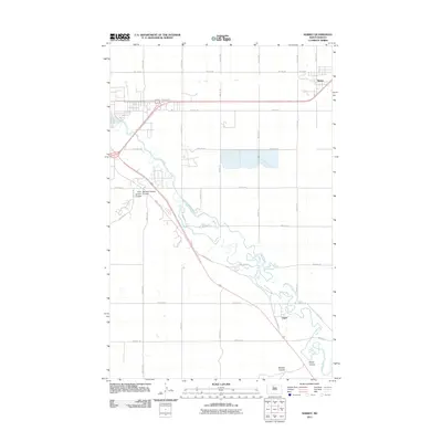
2011 Map of Surrey
USGS Topo · Published 2011About this map
The Souris River meanders through this portion of Ward County, creating a distinct riparian corridor that defines the local topography. This 2011 survey captures the area as the community of Surrey continues to expand southeast of Minot, while the smaller settlement of Logan remains nestled in a bend of the river further south. The landscape is marked by numerous glacial drainage features, most notably the family-named coulees that cut into the prairie, including First Larson Coulee, Second Larson Coulee, Kemp Coulee, and Mostad Coulee. A rigid grid of township roads, such as 54th Ave SE and 72nd St SE, intersects with County Hwy-19, illustrating the intersection of modern suburban growth and traditional agricultural land divisions along Livingston Creek.
Find a feature on this map
32 named features on this map. Tap any name to fly to it.
Don’t see what you’re looking for? This feature index may not catch every label — zoom into the map to look around manually.
Map Details
Editions of this 2011 Surrey Map
This is the sole edition of this map. No revisions or reprints were ever made.
Other maps of this area

1928 · Minot
USGS Topo · 1:62,500

1929 · Sawyer
USGS Topo · 1:62,500

1948 · Sawyer
USGS Topo · 1:24,000

1948 · Burlington
USGS Topo · 1:62,500

1948 · Surrey
USGS Topo · 1:24,000

1949 · Sawyer
USGS Topo · 1:24,000

1949 · Sawyer NE
USGS Topo · 1:24,000

1949 · Deering SW
USGS Topo · 1:24,000

1949 · Deering SE
USGS Topo · 1:24,000

1949 · Burlington SE
USGS Topo · 1:24,000