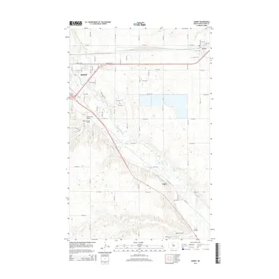
2014 Map of Surrey
USGS Topo · Published 2014About this map
The Souris River meanders through Ward County, shaping the prairie landscape east of Minot. This 2014 survey captures the suburban expansion and industrial infrastructure at the edge of the Magic City, where the BNSF Railway corridor runs parallel to Burdick Expy E. The terrain is defined by a series of distinct glacial drainages, including First Larson Coulee, Second Larson Coulee, and Mostad Coulee, which cut through the surrounding plains. The small settlements of Surrey and Logan serve as secondary hubs along the rail and road networks, illustrating the late-20th-century development patterns of the region. Local researchers will find a detailed residential street grid in Surrey, ranging from 1st St SW to 4th St NE, providing a clear view of the community's modern footprint.
Find a feature on this map
33 named features on this map. Tap any name to fly to it.
Don’t see what you’re looking for? This feature index may not catch every label — zoom into the map to look around manually.
Map Details
Editions of this 2014 Surrey Map
This is the sole edition of this map. No revisions or reprints were ever made.
Other maps of this area

1928 · Minot
USGS Topo · 1:62,500

1929 · Sawyer
USGS Topo · 1:62,500

1948 · Sawyer
USGS Topo · 1:24,000

1948 · Burlington
USGS Topo · 1:62,500

1948 · Surrey
USGS Topo · 1:24,000

1949 · Sawyer
USGS Topo · 1:24,000

1949 · Sawyer NE
USGS Topo · 1:24,000

1949 · Deering SW
USGS Topo · 1:24,000

1949 · Deering SE
USGS Topo · 1:24,000

1949 · Burlington SE
USGS Topo · 1:24,000