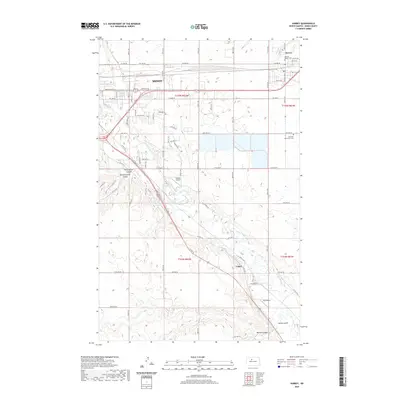
2020 Map of Surrey
USGS Topo · Published 2020About this map
The Souris River meanders through Ward County, carving a valley that separates the growing eastern reaches of Minot from the surrounding prairie. This area shows a landscape defined by both its glacial past and modern infrastructure, where deep ravines like First Larson Coulee and Second Larson Coulee cut into the plateau toward the river bottom. The settlement pattern follows the rail and road corridors, with Surrey at the northeast and the small community of Logan situated along the river to the southeast.
Find a feature on this map
38 named features on this map. Tap any name to fly to it.
Don’t see what you’re looking for? This feature index may not catch every label — zoom into the map to look around manually.
Map Details
Editions of this 2020 Surrey Map
This is the sole edition of this map. No revisions or reprints were ever made.
Other maps of this area

1928 · Minot
USGS Topo · 1:62,500

1929 · Sawyer
USGS Topo · 1:62,500

1948 · Sawyer
USGS Topo · 1:24,000

1948 · Burlington
USGS Topo · 1:62,500

1948 · Surrey
USGS Topo · 1:24,000

1949 · Sawyer
USGS Topo · 1:24,000

1949 · Sawyer NE
USGS Topo · 1:24,000

1949 · Deering SW
USGS Topo · 1:24,000

1949 · Deering SE
USGS Topo · 1:24,000

1949 · Burlington SE
USGS Topo · 1:24,000