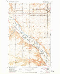
1971 Map of Surrey
USGS Topo · Published 1971About this map
Souris River meanders through the central corridor of this survey, defining a landscape shaped by both glacial drainage and intensive rail development. The settlement of Surrey serves as a northern hub along the Great Northern railroad, while further south, the Logan area sits nestled near the river's bends. This map documents a transition in rural education, preserving the locations of numerous district schoolhouses including School No 21, School No 1, and the Bell Sch No 2 and Bell Sch No 3 sites. Beyond the primary rail lines, the Minneapolis St Paul and Sault Ste Marie line cuts diagonally across the prairie, following the natural valley formed by the river. Communication and industrial infrastructure are evident through the KLPM Radio Station and several Gravel Pits that suggest local resource extraction during this mid-century period.
Find a feature on this map
22 named features on this map. Tap any name to fly to it.
Don’t see what you’re looking for? This feature index may not catch every label — zoom into the map to look around manually.
Map Details
Editions of this 1971 Surrey Map
This is the sole edition of this map. No revisions or reprints were ever made.
Other maps of this area

1928 · Minot
USGS Topo · 1:62,500

1929 · Sawyer
USGS Topo · 1:62,500

1948 · Sawyer
USGS Topo · 1:24,000

1948 · Burlington
USGS Topo · 1:62,500

1948 · Surrey
USGS Topo · 1:24,000

1949 · Sawyer
USGS Topo · 1:24,000

1949 · Sawyer NE
USGS Topo · 1:24,000

1949 · Deering SW
USGS Topo · 1:24,000

1949 · Deering SE
USGS Topo · 1:24,000

1949 · Burlington SE
USGS Topo · 1:24,000