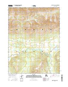
2016 Map of Survey Pass A-2 SE
USGS Topo · Published 2016About this map
Helpmejack Creek winds through the southern reaches of this interior Alaskan landscape, defining the local drainage pattern alongside Lake Creek. The terrain is characterized by a dense network of wetlands and small water bodies concentrated in the lower elevations of Township 19 North, Range 24 East. To the north, the topography rises significantly, showing a series of ridges and valleys within Township 20 North, Range 24 East. This 2016 survey captures the area in its wild state, where the winding path of Helpmejack Creek serves as the primary geographic landmark for navigation or environmental study. The map illustrates the transition from high-elevation relief to the saturated basin floor, providing an essential record of the hydrology and public land survey system grid in this remote section of the Yukon-Koyukuk region.
Find a feature on this map
7 named features on this map. Tap any name to fly to it.
Don’t see what you’re looking for? This feature index may not catch every label — zoom into the map to look around manually.
Map Details
Editions of this 2016 Survey Pass A-2 SE Map
This is the sole edition of this map. No revisions or reprints were ever made.
Other maps of this area

1951 · Hughes
USGS Topo · 1:250,000

1951 · Survey Pass
USGS Topo · 1:250,000

1956 · Hughes
USGS Topo · 1:250,000

1956 · Survey Pass
USGS Topo · 1:250,000

1964 · Survey Pass
USGS Topo · 1:250,000

1964 · Hughes
USGS Topo · 1:250,000

1965 · Hughes
USGS Topo · 1:250,000

1966 · Survey Pass
USGS Topo · 1:250,000
1986 · Hughes D-1
USGS Topo · 1:63,360
1986 · Survey Pass A-1
USGS Topo · 1:63,360