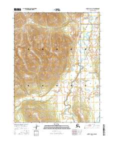
2016 Map of Survey Pass A-4 SW
USGS Topo · Published 2016About this map
Reed River meanders through the eastern portion of this wilderness landscape, serving as a central geographic corridor through a territory defined by its extreme topography. This portion of the Brooks Range shows the transition between the protected interior of the Gates of the Arctic National Park in the northeast and the adjacent Gates of the Arctic National Preserve in the southeast. The survey details a landscape of high-altitude ridges and deep valleys, largely untouched by infrastructure or permanent settlement. This map provides critical topographic context for the headwaters and drainages that feed into the Arctic's larger river systems, illustrating the sharp vertical relief and hydrological patterns that dictate movement through these protected northern lands.
Find a feature on this map
7 named features on this map. Tap any name to fly to it.
Don’t see what you’re looking for? This feature index may not catch every label — zoom into the map to look around manually.
Map Details
Editions of this 2016 Survey Pass A-4 SW Map
This is the sole edition of this map. No revisions or reprints were ever made.
Other maps of this area

1951 · Hughes
USGS Topo · 1:250,000

1951 · Survey Pass
USGS Topo · 1:250,000

1956 · Hughes
USGS Topo · 1:250,000

1956 · Survey Pass
USGS Topo · 1:250,000

1964 · Survey Pass
USGS Topo · 1:250,000

1964 · Hughes
USGS Topo · 1:250,000

1965 · Hughes
USGS Topo · 1:250,000

1966 · Survey Pass
USGS Topo · 1:250,000
1986 · Survey Pass A-5
USGS Topo · 1:63,360
1986 · Survey Pass A-4
USGS Topo · 1:63,360