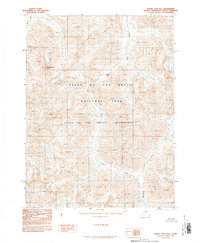
1990 Map of Survey Pass B-6
USGS Topo · Published 1990About this map
Gates of the Arctic National Park dominates this northern Alaskan interior landscape, a territory defined by high elevation peaks and isolated river systems. The Kugrak River and Mauneluk River carve deep valleys through the high terrain, which includes the prominent Shulakpachak Peak and the high-altitude crossing at Danger Pass. This 1990 provisional edition emphasizes the primitive state of the region within the Gates of the Arctic Wilderness, documenting a landscape with no roads or trails. The drainage patterns of Igning River and Luik Creek illustrate the watershed's complexity, providing a detailed view of the Brooks Range topography before modern satellite mapping became commonplace. It is an essential document for understanding the remote character of the Northwest Arctic Borough.
Find a feature on this map
8 named features on this map. Tap any name to fly to it.
Don’t see what you’re looking for? This feature index may not catch every label — zoom into the map to look around manually.
Map Details
Editions of this 1990 Survey Pass B-6 Map
This is the sole edition of this map. No revisions or reprints were ever made.
Other maps of this area

1951 · Survey Pass
USGS Topo · 1:250,000

1951 · Ambler River
USGS Topo · 1:250,000

1956 · Survey Pass
USGS Topo · 1:250,000

1956 · Ambler River
USGS Topo · 1:250,000

1964 · Survey Pass
USGS Topo · 1:250,000

1964 · Ambler River
USGS Topo · 1:250,000

1966 · Survey Pass
USGS Topo · 1:250,000
1985 · Ambler River A-1
USGS Topo · 1:63,360
1986 · Survey Pass A-5
USGS Topo · 1:63,360
1986 · Survey Pass A-6
USGS Topo · 1:63,360