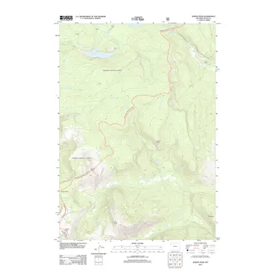
2012 Map of Survey Peak
USGS Topo · Published 2012About this map
Survey Peak and Forellen Peak anchor this high-altitude landscape in Teton County, where the hydrological divide is defined by numerous drainages and glacial lakes. The northern reach is dominated by the Grassy Lake Reservoir and the headwaters of Cascade Cr, while the remote southern section is marked by the winding course of Berry Cr. This terrain showcases the complex alpine geography of the Wyoming backcountry, featuring significant landmarks like Mount Berry and Elk Ridge. Strategically located mountain gaps, including Jackass Pass and Conant Pass, indicate historical routes through these heights. The presence of the Ashton-Flagg Ranch Rd in the northeast provides the primary corridor for human passage through an otherwise roadless expanse of timber and water, including the isolated Lake of the Woods and Hechtman Lake.
Find a feature on this map
21 named features on this map. Tap any name to fly to it.
Don’t see what you’re looking for? This feature index may not catch every label — zoom into the map to look around manually.
Map Details
Editions of this 2012 Survey Peak Map
This is the sole edition of this map. No revisions or reprints were ever made.
Other maps of this area

1886 · Shoshone
USGS Topo · 1:125,000

1888 · Shoshone
USGS Topo · 1:125,000

1895 · Shoshone
USGS Topo · 1:125,000

1899 · Grand Teton
USGS Topo · 1:125,000

1901 · Shoshone
USGS Topo · 1:125,000

1901 · Grand Teton
USGS Topo · 1:125,000

1908 · Shoshone
USGS Topo · 1:125,000

1911 · Shoshone
USGS Topo · 1:125,000

1955 · Ashton
USGS Topo · 1:250,000

1955 · Driggs
USGS Topo · 1:250,000