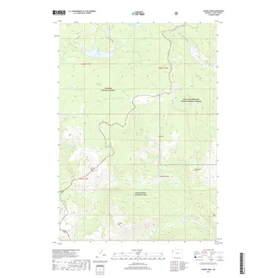
2017 Map of Survey Peak
USGS Topo · Published 2017About this map
Survey Peak and Forellen Peak dominate the high-elevation landscape where three distinct federal land designations converge in Teton County. This 2017 survey documents the intersection of Targhee National Forest, Grand Teton National Park, and the John D Rockefeller Junior Memorial Parkway. The hydrology of the region is defined by drainages such as Berry Cr and Owl Cr, which flow through a network of alpine lakes including Lake of the Woods and Hechtman Lake.
Find a feature on this map
28 named features on this map. Tap any name to fly to it.
Don’t see what you’re looking for? This feature index may not catch every label — zoom into the map to look around manually.
Map Details
Editions of this 2017 Survey Peak Map
This is the sole edition of this map. No revisions or reprints were ever made.
Other maps of this area

1886 · Shoshone
USGS Topo · 1:125,000

1888 · Shoshone
USGS Topo · 1:125,000

1895 · Shoshone
USGS Topo · 1:125,000

1899 · Grand Teton
USGS Topo · 1:125,000

1901 · Shoshone
USGS Topo · 1:125,000

1901 · Grand Teton
USGS Topo · 1:125,000

1908 · Shoshone
USGS Topo · 1:125,000

1911 · Shoshone
USGS Topo · 1:125,000

1955 · Ashton
USGS Topo · 1:250,000

1955 · Driggs
USGS Topo · 1:250,000