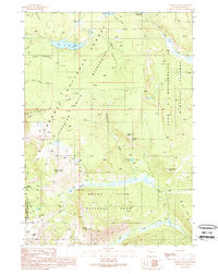
1989 Map of Survey Peak
USGS Topo · Published 1989About this map
Grand Teton National Park and the Jedediah Smith Wilderness meet at the high divide shown in this late twentieth-century study. The landscape is defined by its lack of vehicular roads, instead utilizing a network of Pack Trails that connect remote outposts like the Patrol Cabin near Berry Creek. The topography is anchored by prominent summits including Survey Peak, Mount Berry, and Forellen Peak, while hydrological features such as Lake of the Woods and Hechtman Lake mark the high basins. This document illustrates the preservation of backcountry routes through the Targhee National Forest and along the John D Rockefeller Jr Memorial Parkway, highlighting the corridor's transition from forest to protected wilderness. The inclusion of named passes like Conant Pass and Jackass Pass provides specific detail for those tracing historic travel routes through the northern Teton Range.
Find a feature on this map
26 named features on this map. Tap any name to fly to it.
Don’t see what you’re looking for? This feature index may not catch every label — zoom into the map to look around manually.
Map Details
Editions of this 1989 Survey Peak Map
This is the sole edition of this map. No revisions or reprints were ever made.
Other maps of this area

1886 · Shoshone
USGS Topo · 1:125,000

1888 · Shoshone
USGS Topo · 1:125,000

1895 · Shoshone
USGS Topo · 1:125,000

1899 · Grand Teton
USGS Topo · 1:125,000

1901 · Shoshone
USGS Topo · 1:125,000

1901 · Grand Teton
USGS Topo · 1:125,000

1908 · Shoshone
USGS Topo · 1:125,000

1911 · Shoshone
USGS Topo · 1:125,000

1955 · Ashton
USGS Topo · 1:250,000

1955 · Driggs
USGS Topo · 1:250,000