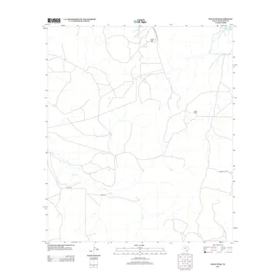
2012 Map of Susan Peak
USGS Topo · Published 2012About this map
Susan Peak and Cedar Knob dominate this section of Tom Green County, where the high-plains landscape is defined by its drainage basins and petroleum infrastructure. The map reveals a transition between water management and energy production, anchored by the Whitehead Reservoir in the northeast and a network of private industrial access ways such as the Marathon Oil Co Road Private. The terrain is etched by seasonal watercourses like Dry Lipan Cr and Pecan Cr, while naming conventions for local thoroughfares like Rocking Chair Rd and Door Key Rd hint at the area's enduring ranching identity and historical property boundaries.
Find a feature on this map
9 named features on this map. Tap any name to fly to it.
Don’t see what you’re looking for? This feature index may not catch every label — zoom into the map to look around manually.
Map Details
Editions of this 2012 Susan Peak Map
This is the sole edition of this map. No revisions or reprints were ever made.
Other maps of this area

1892 · San Angelo
USGS Topo · 1:125,000

1924 · San Angelo 2-c
USGS Topo · 1:48,000

1928 · Wall
USGS Topo · 1:62,500

1954 · San Angelo
USGS Topo · 1:250,000

1957 · Eola
USGS Topo · 1:62,500

1957 · Wall
USGS Topo · 1:62,500

1958 · San Angelo
USGS Topo · 1:250,000

1965 · San Angelo
USGS Topo · 1:250,000

1970 · Rocking Chair Ranch
USGS Topo · 1:24,000
1970 · Kickapoo Spring
USGS Topo · 1:24,000