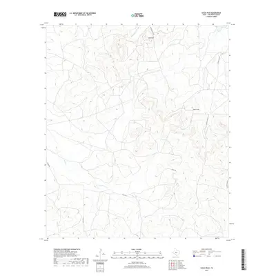
2019 Map of Susan Peak
USGS Topo · Published 2019About this map
Susan Peak and Cedar Knob dominate this high-desert reach of Tom Green County, where the landscape is defined by the drainage networks of Dry Lipan Cr and Pecan Cr. The map reveals a West Texas terrain etched with specialized access ways like Marathon Oil Co Rd and Rocking Chair Rd, reflecting the intersection of the energy industry and traditional ranching. These road names often serve as markers of local land ownership and industrial activity in a region where water sources and high points were critical for navigation. Low-lying drainages intersect with modern tracks like Dewolf Rd and Door Key Rd, providing a clear look at how human movement adapted to the topographical contours of the Edwards Plateau during the early 21st century.
Find a feature on this map
8 named features on this map. Tap any name to fly to it.
Don’t see what you’re looking for? This feature index may not catch every label — zoom into the map to look around manually.
Map Details
Editions of this 2019 Susan Peak Map
This is the sole edition of this map. No revisions or reprints were ever made.
Other maps of this area

1892 · San Angelo
USGS Topo · 1:125,000

1924 · San Angelo 2-c
USGS Topo · 1:48,000

1928 · Wall
USGS Topo · 1:62,500

1954 · San Angelo
USGS Topo · 1:250,000

1957 · Eola
USGS Topo · 1:62,500

1957 · Wall
USGS Topo · 1:62,500

1958 · San Angelo
USGS Topo · 1:250,000

1965 · San Angelo
USGS Topo · 1:250,000

1970 · Rocking Chair Ranch
USGS Topo · 1:24,000
1970 · Kickapoo Spring
USGS Topo · 1:24,000