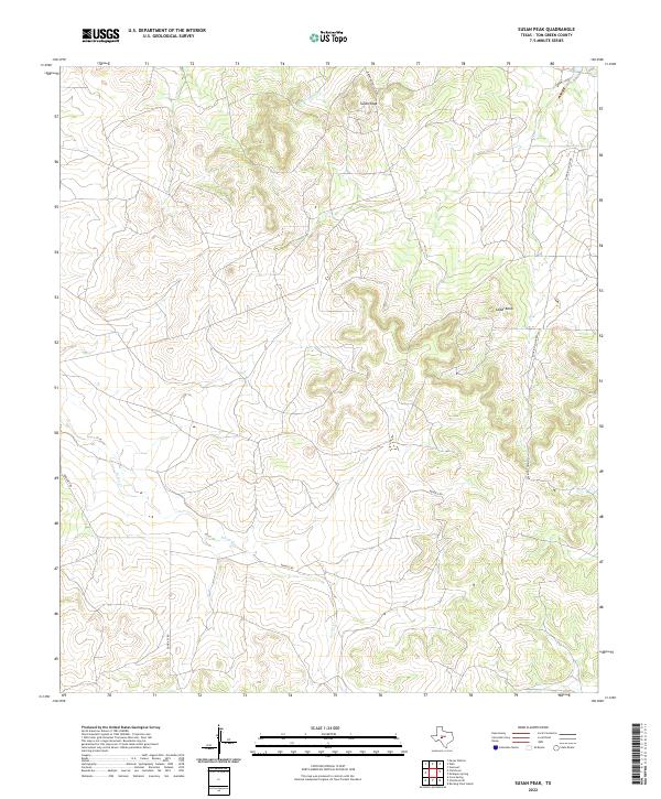
2022 Map of Susan Peak
USGS Topo · Published 2022About this map
Susan Peak and the surrounding rangelands of Tom Green County are defined by an intricate network of ephemeral drainages and rising topography. The landscape is carved by the winding courses of Pecan Cr and Dry Lipan Cr, which dictate the local road patterns and land use. This area of West Texas reflects a ranching and industrial legacy, where naming conventions like Rocking Chair Rd and Door Key Rd signal large, historical land holdings. The presence of Marathon Oil Co Rd indicates the intersection of traditional agriculture with energy resource extraction. Higher elevations at Cedar Knob provide vantage points over the drainage basins, illustrating the sparse but purposeful infrastructure required to manage these expansive cattle and oil territories.
Find a feature on this map
8 named features on this map. Tap any name to fly to it.
Don’t see what you’re looking for? This feature index may not catch every label — zoom into the map to look around manually.
Map Details
Editions of this 2022 Susan Peak Map
This is the sole edition of this map. No revisions or reprints were ever made.
Other maps of this area

1892 · San Angelo
USGS Topo · 1:125,000

1924 · San Angelo 2-c
USGS Topo · 1:48,000

1928 · Wall
USGS Topo · 1:62,500

1954 · San Angelo
USGS Topo · 1:250,000

1957 · Eola
USGS Topo · 1:62,500

1957 · Wall
USGS Topo · 1:62,500

1958 · San Angelo
USGS Topo · 1:250,000

1965 · San Angelo
USGS Topo · 1:250,000

1970 · Rocking Chair Ranch
USGS Topo · 1:24,000
1970 · Kickapoo Spring
USGS Topo · 1:24,000