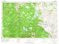
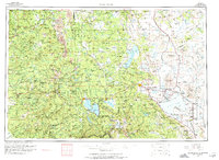
1962 Map of Susanville
USGS Topo · Published 1965About this map
Lassen Volcanic National Park dominates the western topography of this 1962 survey, revealing a landscape defined by dramatic volcanic features like Lassen Peak, Brokeoff Mtn, and the Cinder Cone. To the east, the terrain transitions into the high desert basins of the Madeline Plains and the expansive, shallow waters of Honey Lake. This era shows the region as a critical crossroads for the Southern Pacific and Western Pacific railroads, which serviced timber operations and military installations like the Sierra Army Depot near Herlong.
Find a feature on this map
157 named features on this map. Tap any name to fly to it.
Don’t see what you’re looking for? This feature index may not catch every label — zoom into the map to look around manually.
Map Details
Editions of this 1962 Susanville Map
2 editions found
Other maps of this area

1886 · Alturas
USGS Topo · 1:250,000

1886 · Honey Lake
USGS Topo · 1:250,000

1886 · Lassen Peak
USGS Topo · 1:250,000

1886 · Modoc Lava Bed
USGS Topo · 1:250,000

1886 · Shasta
USGS Topo · 1:250,000

1886 · Granite Range
USGS Topo · 1:250,000

1888 · Bidwell Bar
USGS Topo · 1:125,000

1889 · Long Valley
USGS Topo · 1:250,000

1890 · Red Bluff
USGS Topo · 1:250,000

1890 · Sierraville
USGS Topo · 1:125,000