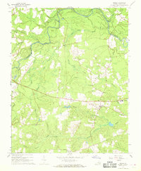
1967 Map of Sussex
USGS Topo · Published 1968About this map
Nottoway River meanders through the heart of the coastal plain in this detailed survey, shaping a landscape defined by an extensive network of swamps and seasonal drainages. Small rural communities like Sussex and West Hope anchor the region, connected by a network of roads that pass by local landmarks like the Lookout Tower and Central High Sch. The map reveals a deeply rooted community life through its numerous religious and educational sites, including Bethel Ch, Red Oak Ch, and Hunting Quarter Ch.
Find a feature on this map
27 named features on this map. Tap any name to fly to it.
Don’t see what you’re looking for? This feature index may not catch every label — zoom into the map to look around manually.
Map Details
Editions of this 1967 Sussex Map
3 editions found
Other maps of this area

1894 · Petersburg
USGS Topo · 1:62,500

1919 · Jarratt
USGS Topo · 1:62,500

1919 · Disputanta
USGS Topo · 1:62,500

1919 · Homeville
USGS Topo · 1:48,000

1920 · Homeville
USGS Topo · 1:62,500

1943 · Sebrell
USGS Topo · 1:31,680

1943 · Littleton
USGS Topo · 1:31,680

1943 · Richmond
USGS Topo · 1:250,000

1944 · Reams
USGS Topo · 1:31,680
1944 · Nebletts Mill
USGS Topo · 1:31,680