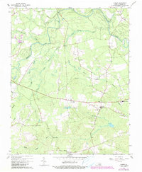
1967 Map of Sussex
USGS Topo · Published 1990About this map
Sussex serves as a central hub in this Southern Virginia landscape, where the Nottoway River and its complex network of tributaries like Rowanty Creek and Gosee Swamp define the topography. The map illustrates a rural society deeply rooted in its local institutions, evidenced by the numerous country churches such as Reidville Ch and Hunting Quarter Ch. These landmarks, along with the Lookout Tower near the town center, provide essential reference points for the scattered residential pockets of West Hope and Booker.
Find a feature on this map
33 named features on this map. Tap any name to fly to it.
Don’t see what you’re looking for? This feature index may not catch every label — zoom into the map to look around manually.
Map Details
Editions of this 1967 Sussex Map
3 editions found
Other maps of this area

1894 · Petersburg
USGS Topo · 1:62,500

1919 · Jarratt
USGS Topo · 1:62,500

1919 · Disputanta
USGS Topo · 1:62,500

1919 · Homeville
USGS Topo · 1:48,000

1920 · Homeville
USGS Topo · 1:62,500

1943 · Sebrell
USGS Topo · 1:31,680

1943 · Littleton
USGS Topo · 1:31,680

1943 · Richmond
USGS Topo · 1:250,000

1944 · Reams
USGS Topo · 1:31,680
1944 · Nebletts Mill
USGS Topo · 1:31,680