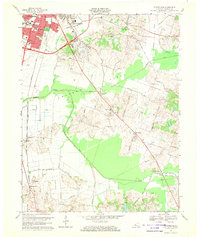
1968 Map of Sutherland
USGS Topo · Published 1970About this map
Owensboro expands south in the late 1960s, showing a suburban landscape where educational institutions like Kentucky Wesleyan College and the County High Sch meet rural farmland. The northern edge of the map is dense with civic landmarks, including Legion Park and Rose Hill Cem, while the southern reaches transition into the broad floodplains of Jackson Flats. This area is defined by the winding course of Panther Creek and its many forks, which historically shaped the placement of outlying communities.
Find a feature on this map
66 named features on this map. Tap any name to fly to it.
Don’t see what you’re looking for? This feature index may not catch every label — zoom into the map to look around manually.
Map Details
Editions of this 1968 Sutherland Map
3 editions found
Other maps of this area

1901 · Owensboro
USGS Topo · 1:62,500

1903 · Tell City
USGS Topo · 1:62,500

1906 · Sutherland
USGS Topo · 1:62,500

1907 · Whitesville
USGS Topo · 1:62,500

1909 · Whitesville
USGS Topo · 1:62,500

1952 · Owensboro East
USGS Topo · 1:24,000

1952 · Owensboro West
USGS Topo · 1:24,000

1953 · Philpot
USGS Topo · 1:24,000

1953 · Sutherland
USGS Topo · 1:24,000

1953 · Utica
USGS Topo · 1:24,000