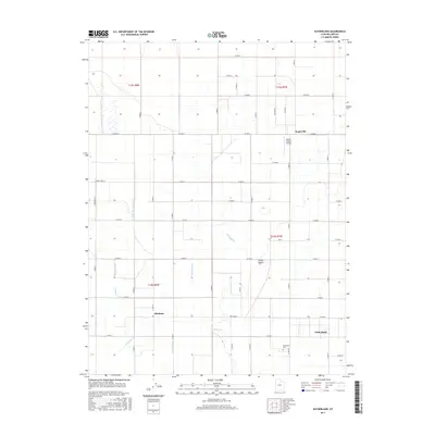
2017 Map of Sutherland
USGS Topo · Published 2017About this map
The Sevier Desert defines the landscape of this western Utah region, where a complex network of man-made waterways supports the small agricultural settlements of Sutherland and Abraham. This 2017 survey reveals the intricate irrigation system required for desert farming, featuring the Abraham Canal, Little Abraham Canal, and Wilson Canal alongside various ditches such as the Tolbert Ditch. Near the northern border lies Sugarville, while the Desert Aviation Airport stands as a focal point for local transportation. For family historians, the Sutherland Cem is clearly marked south of the town center. The rigid grid of section lines and gravel roads, such as W 7500 N, contrasts with the winding paths of the Reid Canal and Gronning Canal, illustrating the human effort to manage water in an arid environment.
Find a feature on this map
34 named features on this map. Tap any name to fly to it.
Don’t see what you’re looking for? This feature index may not catch every label — zoom into the map to look around manually.
Map Details
Editions of this 2017 Sutherland Map
This is the sole edition of this map. No revisions or reprints were ever made.
Other maps of this area

1885 · Sevier Desert
USGS Topo · 1:250,000

1953 · Delta
USGS Topo · 1:250,000

1958 · Delta
USGS Topo · 1:250,000

1962 · Delta
USGS Topo · 1:250,000

1962 · Delta
USGS Topo · 1:62,500

1971 · Smelter Knolls East
USGS Topo · 1:24,000

1971 · Baker Hot Springs
USGS Topo · 1:24,000

1971 · Rain Lake
USGS Topo · 1:24,000

1971 · Fumarole Butte
USGS Topo · 1:24,000
1971 · Crafts Lake
USGS Topo · 1:24,000