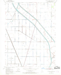
1952 Map of Sutter Causeway
USGS Topo · Published 1952About this map
The Sutter By-Pass dominates this 1952 topographic study, showing a critical piece of Central Valley water management infrastructure designed to handle seasonal inundation. The diagonal corridor of the bypass is flanked by the East Canal and a Private Canal, creating a distinct diagonal rift through the otherwise grid-aligned agricultural landscape of Sutter County. The small settlement of Subaco sits along the Southern Pacific (Reclamation) rail line, which served the local agricultural economy during the mid-century era.
Find a feature on this map
33 named features on this map. Tap any name to fly to it.
Don’t see what you’re looking for? This feature index may not catch every label — zoom into the map to look around manually.
Map Details
Editions of this 1952 Sutter Causeway Map
4 editions found
Other maps of this area

1888 · Marysville
USGS Topo · 1:125,000

1891 · Marysville
USGS Topo · 1:125,000

1894 · Marysville
USGS Topo · 1:125,000

1895 · Marysville
USGS Topo · 1:125,000

1907 · Dunnigan
USGS Topo · 1:62,500

1910 · Knights Landing
USGS Topo · 1:31,680

1910 · Vernon
USGS Topo · 1:31,680

1910 · Nicolaus
USGS Topo · 1:31,680

1910 · Marcuse
USGS Topo · 1:31,680

1911 · Gilsizer Slough
USGS Topo · 1:31,680