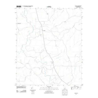
2011 Map of Suttle
USGS Topo · Published 2011About this map
The Cahaba River winds through this section of Alabama, defining a landscape shaped by rural settlements and family landmarks. The village of Suttle serves as a local hub, anchored by the Suttle Post Office and nearby Suttle Cemetery. To the north, the community of Radford sits at a crossroads, surrounded by numerous family-named burial grounds including Edwards Cemetery and Bethany Cemetery.
Find a feature on this map
32 named features on this map. Tap any name to fly to it.
Don’t see what you’re looking for? This feature index may not catch every label — zoom into the map to look around manually.
Map Details
Editions of this 2011 Suttle Map
This is the sole edition of this map. No revisions or reprints were ever made.
Other maps of this area

1953 · Montgomery
USGS Topo · 1:250,000

1956 · Montgomery
USGS Topo · 1:250,000

1957 · Montgomery
USGS Topo · 1:250,000

1958 · Selma
USGS Topo · 1:62,500

1958 · Selma
USGS Topo · 1:24,000

1959 · Summerfield
USGS Topo · 1:62,500

1968 · Browns
USGS Topo · 1:24,000

1975 · Selma NW
USGS Topo · 1:24,000

1975 · Summerfield SW
USGS Topo · 1:24,000
1975 · Summerfield SE
USGS Topo · 1:24,000