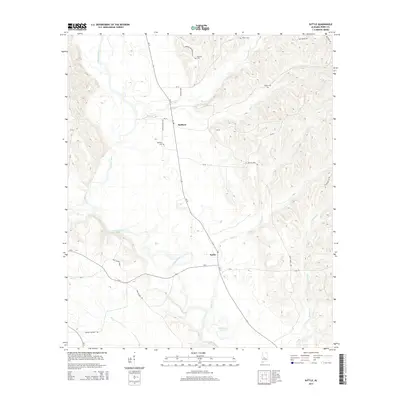
2014 Map of Suttle
USGS Topo · Published 2014About this map
The Cahaba River winds through this section of Alabama, framing a landscape defined by small rural settlements and a dense network of family-named landmarks. Near the center of the map, Radford sits at the junction of Al-14 and Pett Suttle Loop, while the community of Suttle lies to the south, where Silver Cr flows toward Vaughans Lake. The terrain is marked by numerous watercourses, including Holley Cr, Possum Cr, and Rice Cr, which cut through the hills. For genealogists, the map is particularly useful for identifying local burial sites such as Bethany Cem, Edwards Cem, and Suttle Cem. The road network, including family-associated routes like Herman Richardson Rd and Pink Wilson Rd, reflects the long-standing agricultural and residential patterns of this part of Perry County.
Find a feature on this map
33 named features on this map. Tap any name to fly to it.
Don’t see what you’re looking for? This feature index may not catch every label — zoom into the map to look around manually.
Map Details
Editions of this 2014 Suttle Map
This is the sole edition of this map. No revisions or reprints were ever made.
Other maps of this area

1953 · Montgomery
USGS Topo · 1:250,000

1956 · Montgomery
USGS Topo · 1:250,000

1957 · Montgomery
USGS Topo · 1:250,000

1958 · Selma
USGS Topo · 1:62,500

1958 · Selma
USGS Topo · 1:24,000

1959 · Summerfield
USGS Topo · 1:62,500

1968 · Browns
USGS Topo · 1:24,000

1975 · Selma NW
USGS Topo · 1:24,000

1975 · Summerfield SW
USGS Topo · 1:24,000
1975 · Summerfield SE
USGS Topo · 1:24,000