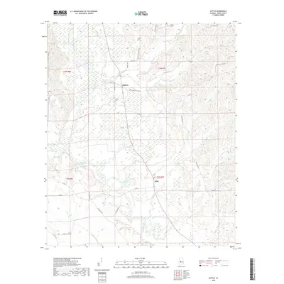
2018 Map of Suttle
USGS Topo · Published 2018About this map
The Cahaba River winds through the heart of Perry County, Alabama, shaping a landscape defined by its floodplains and tributary creeks. In the vicinity of Radford and Suttle, the topography is characterized by the meandering river path and the intricate drainage networks of Waters Cr, Dry Cr, and Silver Cr. This 2018 survey reveals a rural infrastructure where family and community heritage is preserved in numerous burial grounds, including Bethany Cem, Suttle Cem, and Waters Cem.
Find a feature on this map
38 named features on this map. Tap any name to fly to it.
Don’t see what you’re looking for? This feature index may not catch every label — zoom into the map to look around manually.
Map Details
Editions of this 2018 Suttle Map
This is the sole edition of this map. No revisions or reprints were ever made.
Other maps of this area

1953 · Montgomery
USGS Topo · 1:250,000

1956 · Montgomery
USGS Topo · 1:250,000

1957 · Montgomery
USGS Topo · 1:250,000

1958 · Selma
USGS Topo · 1:62,500

1958 · Selma
USGS Topo · 1:24,000

1959 · Summerfield
USGS Topo · 1:62,500

1968 · Browns
USGS Topo · 1:24,000

1975 · Selma NW
USGS Topo · 1:24,000

1975 · Summerfield SW
USGS Topo · 1:24,000
1975 · Summerfield SE
USGS Topo · 1:24,000